
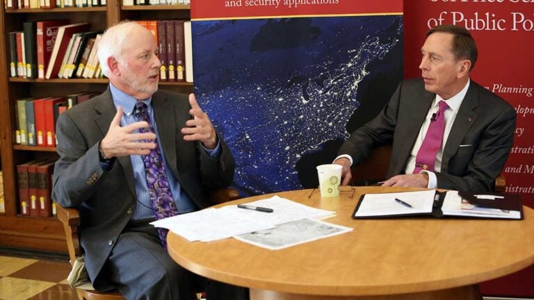
Steven Lamy, vice dean for academic programs, and retired Gen. David Petraeus (Photo by Mike Glier)
USC Dornsife introduces new minor in human security
Students use spatial thinking to enhance their skills in disaster response
How often do you think about human security?
Human security can be threatened by natural disasters — earthquakes, hurricanes and floods — as well as human actions such as terrorism, humanitarian crises and warfare. As our global society becomes more interconnected, government agencies, scholars and international decision makers must have the knowledge and capacity to quickly assess and act to provide humanitarian aid in a crisis situation.
Retired Gen. David Petraeus, a Judge Widney Professor at USC and former CIA director, visited the University Park Campus this month for a number of events, including a roundtable discussion focused on geospatial intelligence, or GEOINT, and its role in optimizing human security. Other panelists included Steven Lamy, vice dean for academic programs and professor of international relations; Michael Orosz, assistant director of the USC Viterbi School of Engineering’s Information Sciences Institute; and retired Col. Steven Fleming, professor of the practice of spatial sciences.
GEOINT is information about human activity on earth that is derived from the analysis of maps, imagery and other location-specific data. It has become increasingly important both in terms of national security and for global humanitarian, public health and disaster response efforts.
“GEOINT is enabling a true transformation in how we are fighting terrorists around the world,” Petraeus said. “This is revolutionary stuff.”
Putting learning to use
Responding to this growing phenomenon, the Spatial Sciences Institute (SSI) at the USC Dornsife College of Letters, Arts and Sciences launched a new interdisciplinary minor in human security and geospatial intelligence this fall.
The program is designed to educate future leaders in location-based analytics and provide a framework for students wanting to learn how to develop geospatial solutions to global challenges.
“We wanted to create a major or minor in something that undergraduates could use right out of the blocks in their professional world,” said Fleming, one of the key developers of the minor program.
The minor complements majors in international relations, political science, environmental studies, majors studying global regions and geodesign. It is also applicable to cadets of various majors in USC’s ROTC commands.
Fleming, who served for 30 years as an officer in the U.S. Army and now serves on USC’s military affairs committee, said that this material will be immediately useful to ROTC students as newly commissioned officers starting their service.
For other students, such as those interested in working at the U.S. State Department, for example, or those wishing to round out what they’re learning in other academic majors, Fleming said the minor will further contextualize many of the global issues they’re learning about.
Petraeus praised SSI and the university for its trailblazing academic programs.
“Kudos to SSI, a very impressive initiative at USC,” he said. “It’s another area in which USC is ‘walking point’ for a particular endeavor in the academic world and bringing various disciplines together as well. It’s truly cutting-edge technology.”